Geography Mapping
10.7K subscribers
About Geography Mapping
■ Maps All For Prelims & Mains ■ Places in News ■ Rivers ■ National Parks
Similar Channels


Swipe to see more
Posts
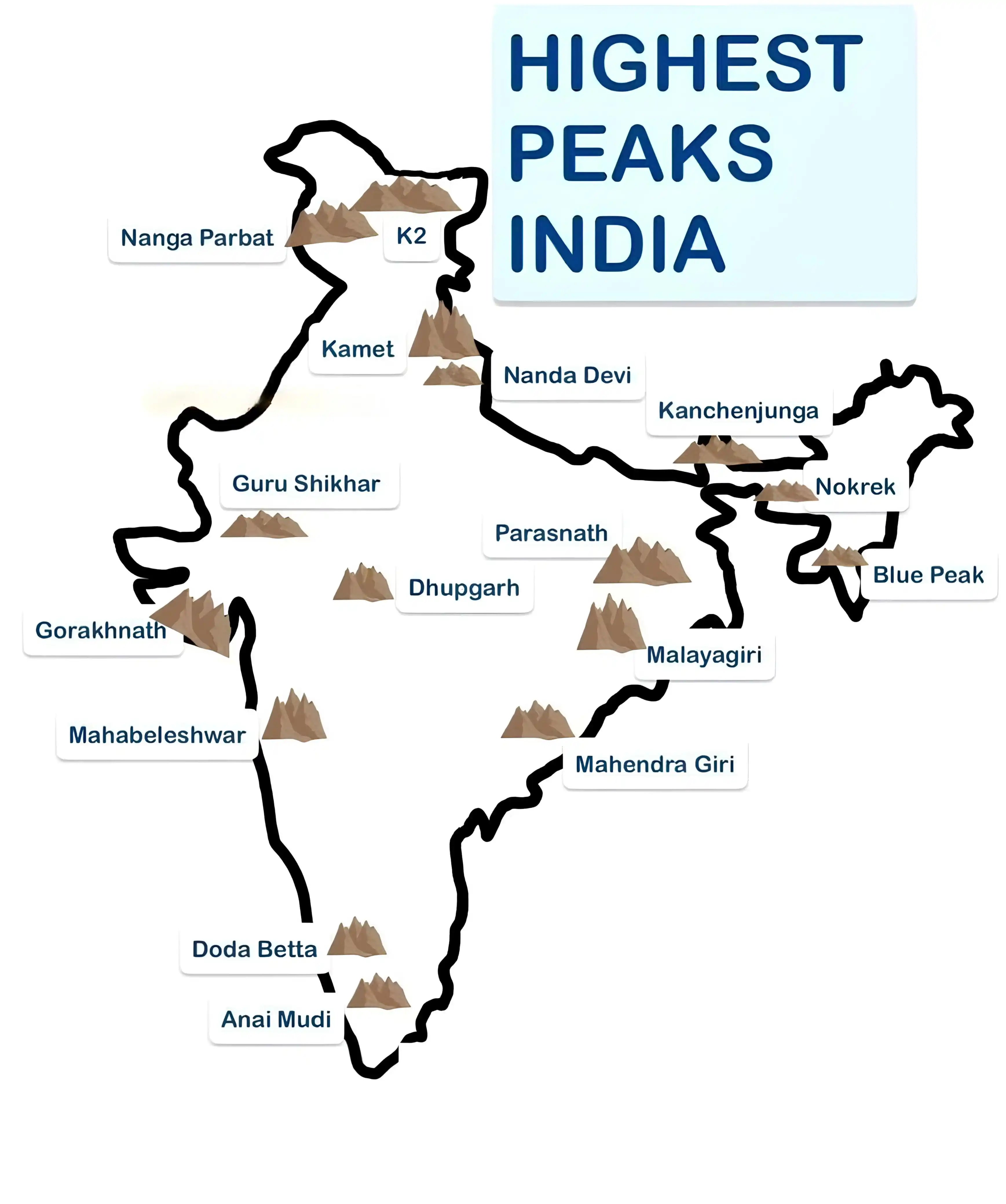
🌋 *Mountain Ranges* #Prelims #Mains
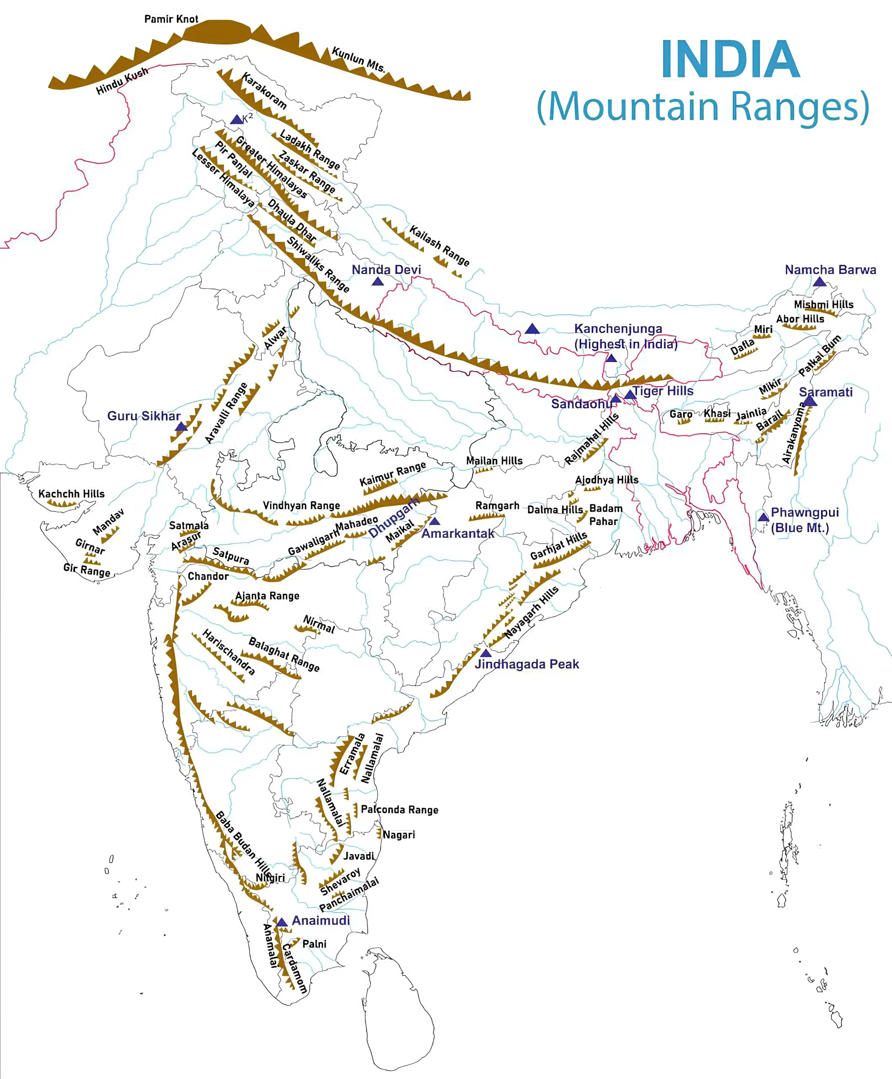
*_🏔️ Highest mountain peaks in India_* *📍 Kanchenjunga, Nanda Devi and Kamet are the 1st, 2nd and 3rd highest mountain peaks of India.* _✅ Specific questions are coming in Prelims related to Anaimuddi, Dodabeta.
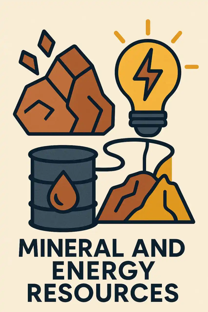
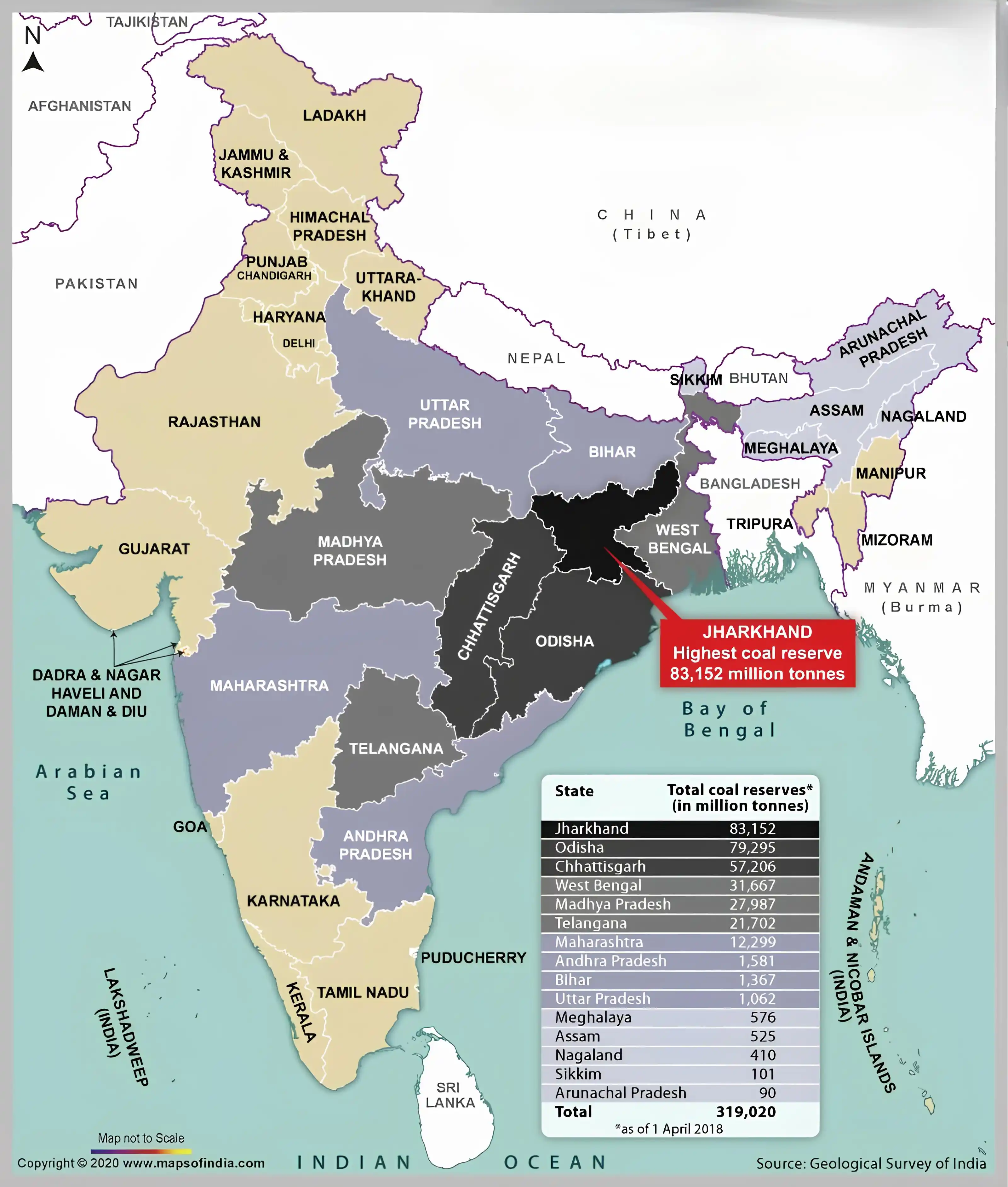
*🔍 Mineral and Energy Resources – Key Points* *Mineral resources*- Metallic & Non-metallic *Metallic*- Ferrous (iron ore) & Non-ferrous (copper) *Non-metallic*- Organic (coal, petroleum) & Inorganic (mica, limestone) *Exploration by*- GSI, IBM, & State Departments *✅ Mineral Belts in India* *1. 🟡 North-Eastern*- iron ore, coal, bauxite *2. 🟠 South-Western*- ferrous metals, bauxite *3. 🔵 North-Western*- copper, building stones *🛠 Odisha*- largest iron ore & bauxite producer *🟤 Madhya Pradesh & Odisha*- major manganese producers *💎 Andhra Pradesh*- largest mica producer *⚫️ Jharkhand*- highest coal reserves *🏭 Chhattisgarh*- top coal producer *🛢 Rajasthan*- top petroleum producer *☢️ Uranium & Thorium*- vital for nuclear energy *🌞 Renewables*- solar, wind, tidal, geothermal, biogas
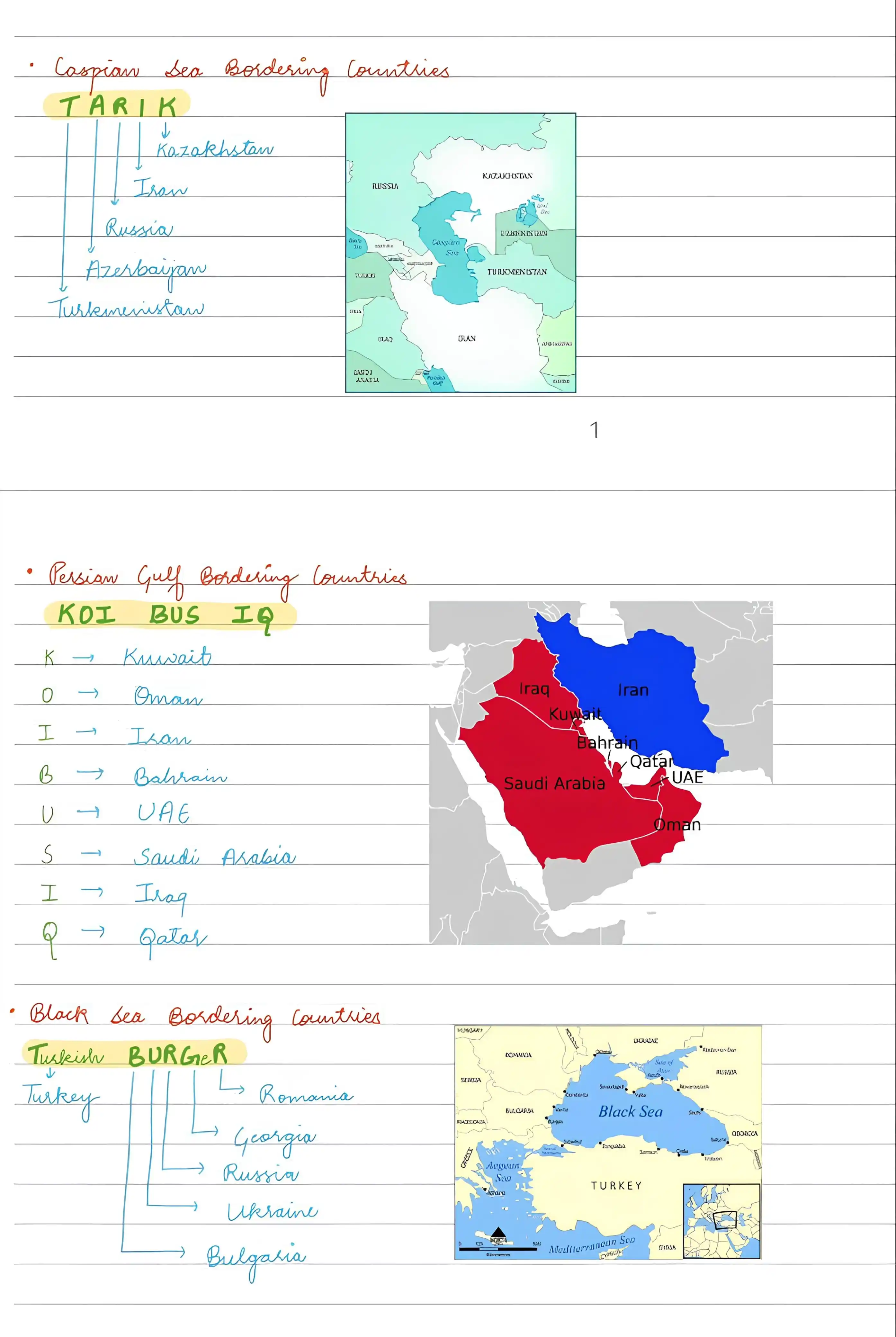
*🪖 Caspian sea ,Persian Gulf and Black Sea bordering countries 🪵🌴*
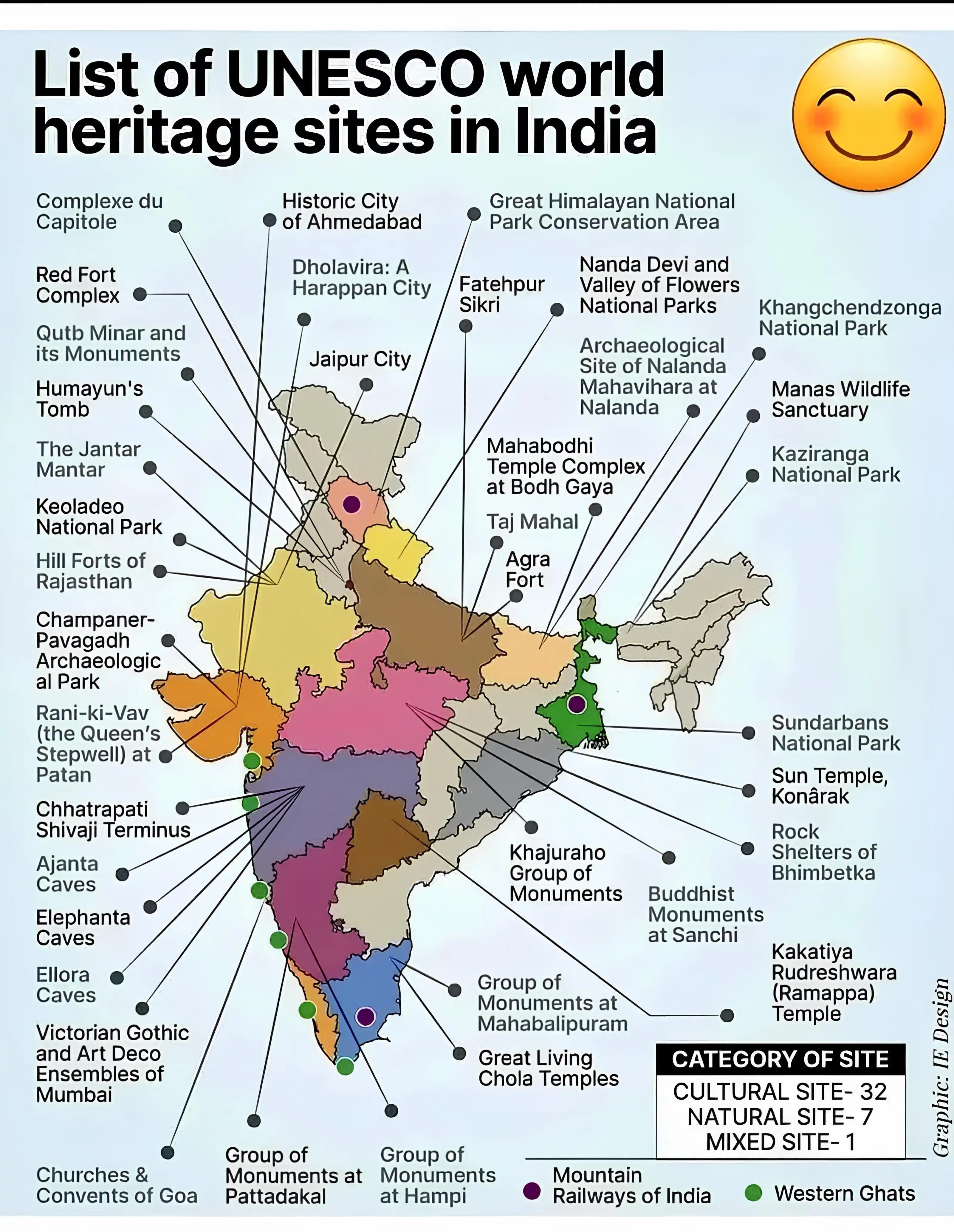
List of UNESCO World Heritage Sites in India
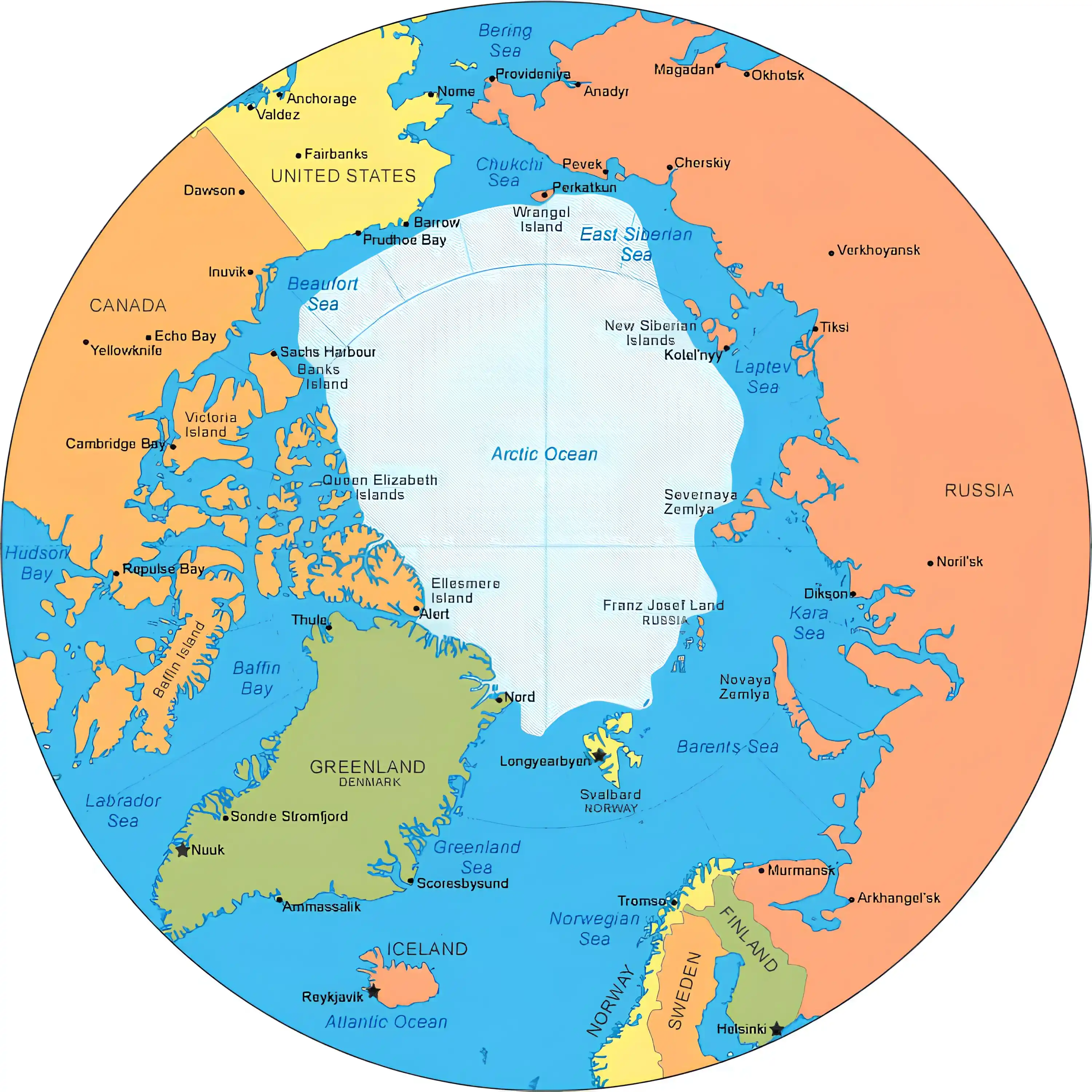
> *Countries Bordering Arctic Sea* *_📍 Trick : Green FISH went to Norway by CAR_* ✅ G : Greenland ✅ F : Finland ✅ I : Iceland ✅ S : Sweden ✅ N : Norway ✅ C : Canada ✅ A : Alaska ✅ R : Russia
#River_India ▪️ *Top ten Rivers India* River - Length (in India) 1. Ganges -2,525 Km 2. Godavari- 1,465 Km 3. Krishna -1,400 Km 4. Narmada- 1,313 Km 5. Yamuna -1,211 Km 6. Indus -1,114 Km 7. Brahmaputra -916 Km 8. Mahanadi -851 Km 9. Kaveri- 800 Km 10. Tapi -724 Km