
Prassanna
36 subscribers
Similar Channels


Swipe to see more
Posts
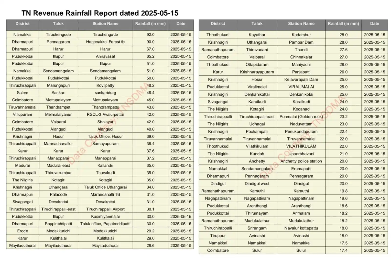
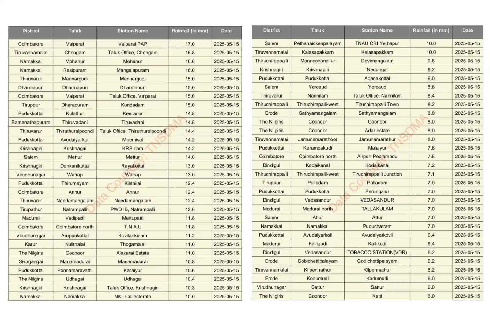
The last leg of pre-monsoon rains have picked up pace in TN. Yesterday many districts saw rains except for the throat region North TN. Now parts of West, South TN seeing thunderstorms. Moving ahead, North interiors to parts of Delta will join too. Bangalore show will continue.
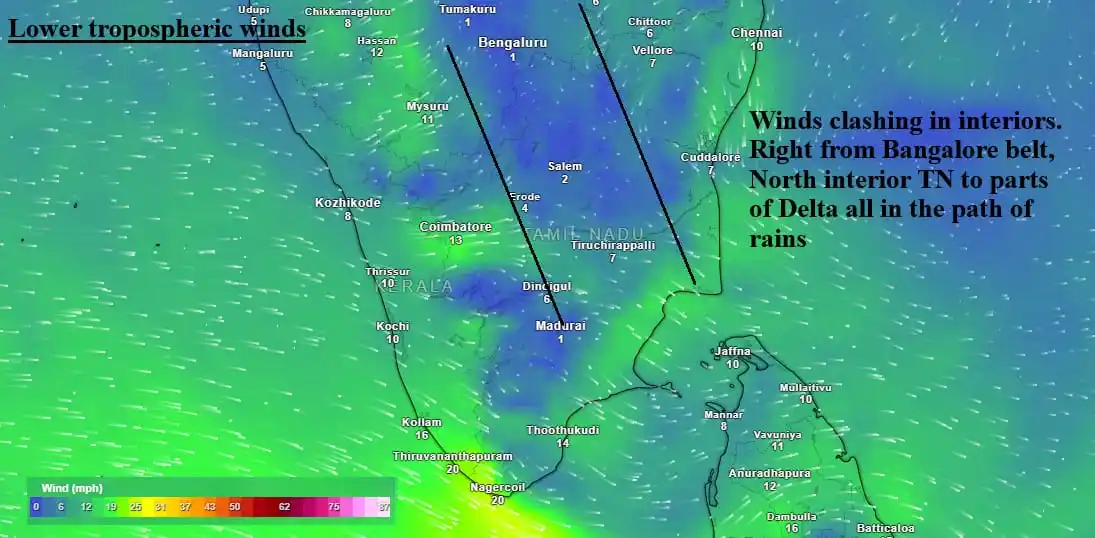
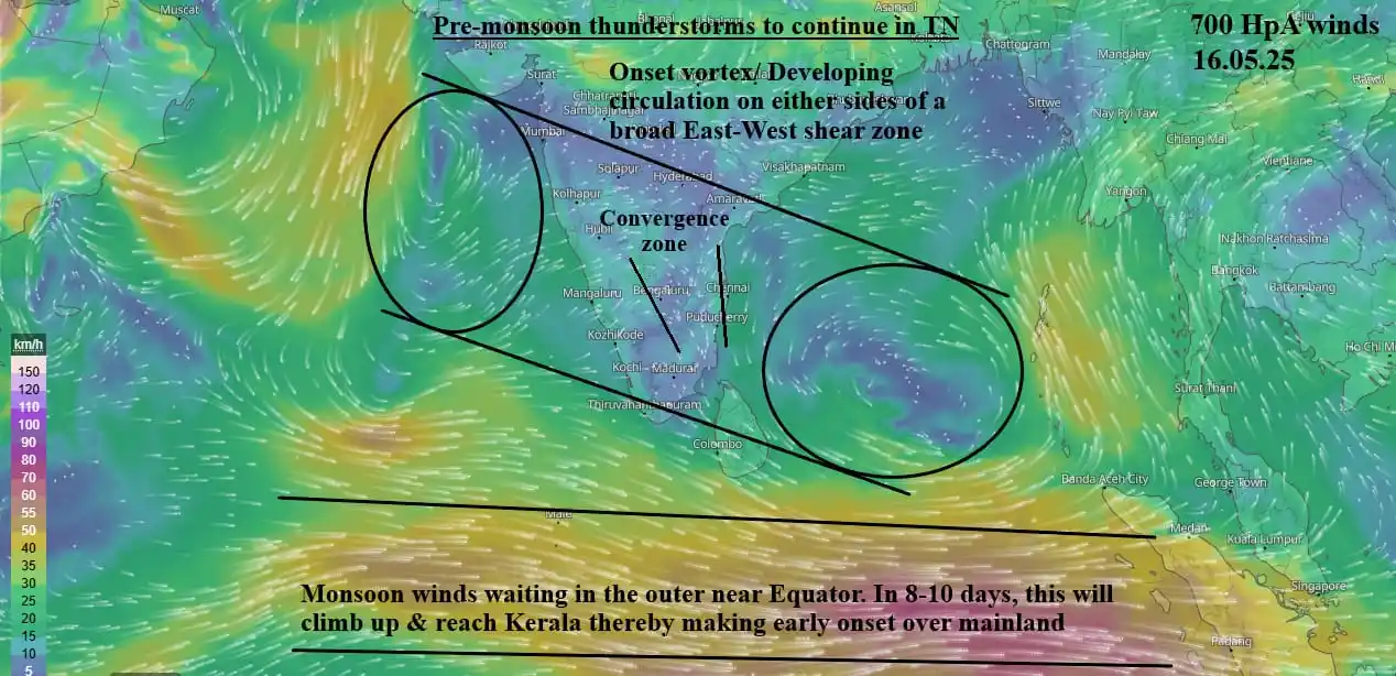
Massive day ahead for TN, North interior TN in hotspot -- Except for places near Palakkad pass, Tuty-Nellai belt where westerlies dominate, most districts ideally placed for rains. Can #Chennai break the shackles? Interesting night ahead. #Bangalore will continue its wet run.
#Trichy == Steady rise in temp in last 3days. Today's maximum crossed 40C to end at 40.3C Manachanalur belt in North, Thuvarankurichi belt in South got some meaningful rains District rainfall for May -- Normal: 65mm Actual so far: 37mm Next 7-10days are key for a few sambavams
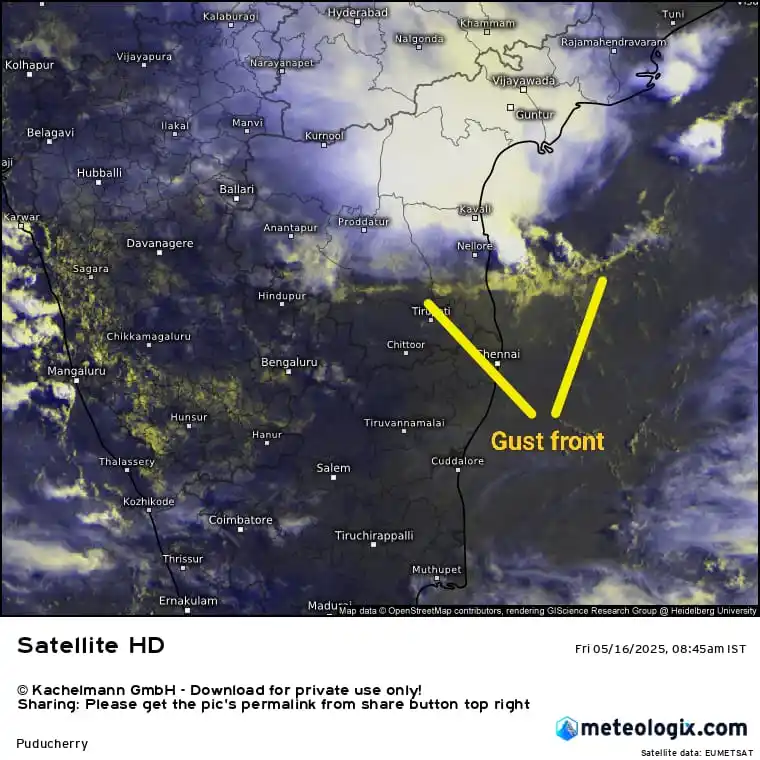
KTCC (Chennai & surroundings) -- Keep a watch on storms from South AP. There is a chance for reaching North TN in next 1.5-3hrs. Gust front seen at the leading edge of the storms. Don't be surprised if there is sudden pickup in winds. Here on, #Chennairains chances improve !!
Excellent rains from North interior TN towards coastal Delta where mass convergence happened. Today will be similar too for TN with BLR to SLM, TVMalai belt, #Trichy-Delta in hotspot. #Chennai got some isolated rains. Bay circulation will near us in 24-36hrs, better rains await.
#Bangalore getting a push in May == It's been a mild summer with frequent rains from March. Of all the pre-monsoon months (March to May), May is the rainiest After nearly 10days of lull, rains have picked up in the last 2days. Today too, storms ahead Time for BLR rains to trend
#Trichy - Same tailor, same rent. Another hot day with 50-50 chance of rains later. Yesterday ended at 39.9C. Today again, same 39C at 2.30pm. Final maximum will be close to or 40C. Towards South -- Today to tomorrow Dindugal & nearby dts, Pudukottai-SVG belt ideal for rains.