Upper River Cam & Tributaries. Flood Alerts from Blackford River Level Gauge. See full details/links
169 subscribers
About Upper River Cam & Tributaries. Flood Alerts from Blackford River Level Gauge. See full details/links
Community Channel River Cam Flood Alerts: River Level gauge Blackford Bridge (installed Jan 2024), BA22 7EE. Alerts are issued on rising levels at Blackford Bridge: AMBER 0.60m RED 0.94m No alerts are issued for falling levels. "Normal" river levels around: Summer: 0.20m Winter: 0.30m Historical Min/max (from new gauge) 6.2.24 0.16m 30.09.24 0.95m Red Alerts 2024: 1 2025: 1 Est all time Min/max Low: 0.10m? High: 1.35 - 1.50m? 9th May 2023 Estimated breaks banks 1.10 to 1.20m Alerts are an indicator of potential flooding but every event will be different according to intensity of rainfall, ground saturation and other factors River Cam catchment: Blackford, Compton Pauncefoot, Galhampton, Ilchester, Maperton, North Cadbury, Podimore, South Cadbury, Sparkford, Queen Camel, West Camel, Woolston, Yarlington etc Alerts likely to be useful downstream e.g. Marston Magna, Mudford catchment of River Cam/Yeo. River Cam flows into Yeo then Parrett. Shepton Montague, Pitcombe/Hadspen area flows into River Pitt & onwards into Brue then joins Parrett. Holton & Wincanton area flows into River Cale & onwards into Stour & English Channel. Members/followers may not use this channel for general chat. You can react to a message with an emoji! e.g. 👍🤞😱 😟😰 Feel free to share this channel link with friends and family. We do NOT gather any information about you & other members cannot see you unless already a contact Follow the Upper River Cam & Tributaries. Flood Alerts from Blackford River Level Gauge. WhatsApp channel: https://whatsapp.com/channel/0029VaDbh9KCXC3GHj3iAv3t or https://tinyurl.com/BlackfordAlerts We welcome comments or feedback An Emergency Preparedness document available on request Free app with alerts: RiverApp https://www.riverapp.net/en https://check-for-flooding.service.gov.uk/target-area/112FWFCAM10A?v=map-live&lyr=mv,ts,tw,ta&fid=flood.112FWFCAM10A&ext=-2.627104,50.948351,-2.480618,51.113 This service is provided as a free service and aid to you without warranty, guarantees or liability
Similar Channels

MondoRossoBlù.it 🔴🔵

First Aid Ghana 🇬🇭 | Emergency Care & Safety

Rêz û Piştîvanî

Peek Freans Young Piper’s Club
KUDAKU

I AM AN NITIAN Family.

betterlife.builders

Learn English | IELTS | Grammar | English Speaking | AI Tools | Learn IELTS TOEFL English

TRENDY _FISSION _MERCHANTS....F83💥💥💥 THE SHOE HUB 💯💯🔥

Affordable Protection Services
Future Officers Junction ⚔️🎖️

ಆರೋಗ್ಯವೇ ಭಾಗ್ಯ ಮತ್ತು ಅತ್ಯಂತ ಪ್ರಮುಖ ಮಾಹಿತಿ

Medical Negligence Action Network

Eloquence Online English Academy Channel

giggle──fizz: “ornithic.”
Swipe to see more
Posts
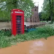
More than 20 months after the flooding a report into the events of 9th May 2023 has been released and may be downloaded from: https://www.somerset.gov.uk/beaches-ports-and-flooding/flood-investigations/ Our report is "East Cam Valley" and includes North & South Cadbury as well as Blackford and Compton Pauncefoot etc. Other nearby reports maybe of interest in order to understand the complete picture. includes 5 main reports East Cam Valley Galhampton, North Cadbury, South Cadbury, Blackford, Compton Pauncefoot and Yarlington West Camel & Urgashay Central Cam Valley Queen Camel, Sparkford, Weston Bampfylde West Cam Valley Podimore, Yeovilton Pitt Valley Shepton Montague, Hadspen & Pitcombe With so many flood events across Somerset over the last 2 years we are grateful to everyone that contributed and to Somerset Council Officers and Councillors for the completed report. The report includes general (and a few specific) recommendations arising from the investigation but does not in itself determine works or provide funding. It provides a good basis for further discussion and decision making.
*AMBER Alert* triggered at 01:45am 0.60m depth. Further rain is expected until morning followed by showers so while upstream flooding around Blackford is unlikely accumulated runoff is more likely to be a problem downstream. Wind has reduced. *Informal View* Vicinity of Blackford & Upper Cam: not currently expected to see significant flooding from River and/or Runoff* Downstream River Cam & River Yeo: may see flooding from River and/or Runoff* Further bands of rain are expected overnight and tomorrow. You should take appropriate action - refer to our Emergency Preparedness document (available on request). .* You should make your own assessment and check with official sources including Environment Agency, MetOffice, Somerset Council We will not issue a further alert unless levels rise significantly