
UPSC mapping UPSC UPSC UPPSC MPPSC UPSC UPSC Upsc UPSC UPSC UPSC UPSC UPSC UPSC BPSC SSC CSAT UPSC™
June 12, 2025 at 02:00 PM
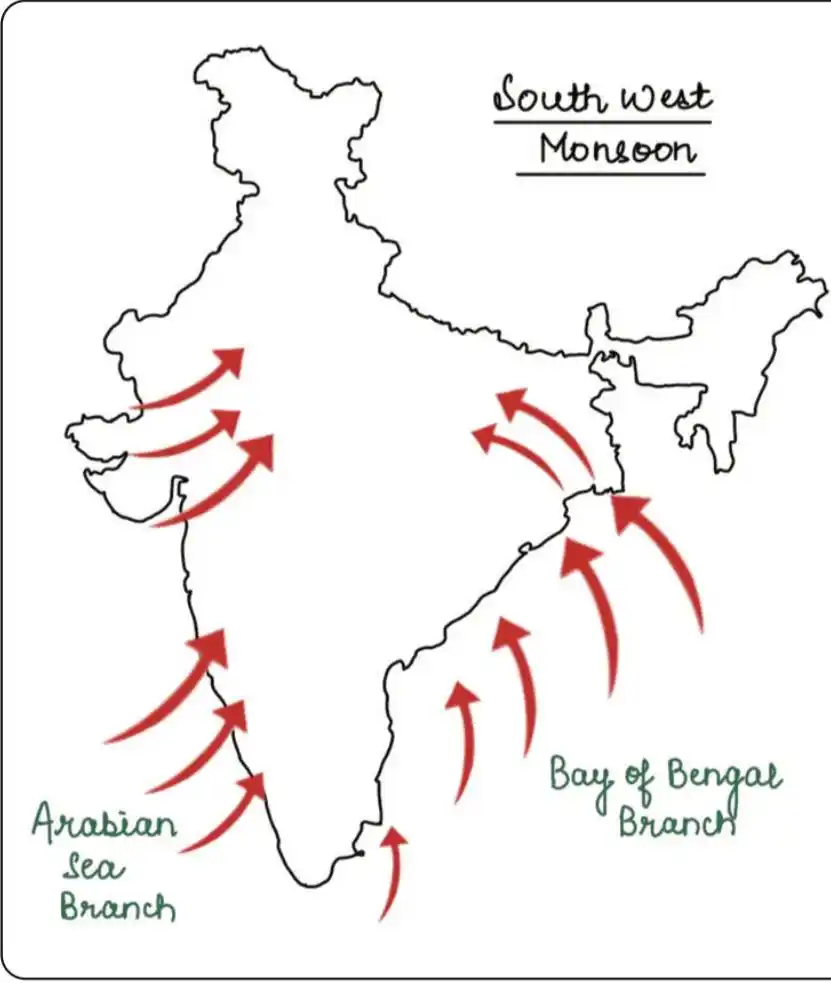
🔆 Rain-Bearing Systems
📍 Arabian Sea Branch
✅ Divides into three streams:
• Western Coast: Heavy rainfall (250 cm) due to orographic effect.
• Narmada-Tapi troughs: Narrow valley system in central India.
• Aravalli Range: Minimal rainfall impact.
📍 Bay of Bengal Branch
✅ Splits into two streams:
• Ganga-Brahmaputra delta: Heavy rainfall, Cherrapunji (1,221 cm) holds record.
• Himalayan foothills: Deflected by mountains, widespread rainfall to Ganges Plain.
📍 Monsoon Break
✅ Dry spells during monsoon, known as break in monsoon, common after a few days of rain.
📍 Retreat in Monsoon
✅ Withdrawal of monsoon winds, known as retreating monsoon, occurs in October-November.
#geography
Join https://t.me/Mapping_prelims_mains
❤️
😢
🙏
4